– All from National Geographic Society
Five (5) vintage maps, in excellent condition,.. $4.00 each, or Give me an Offer
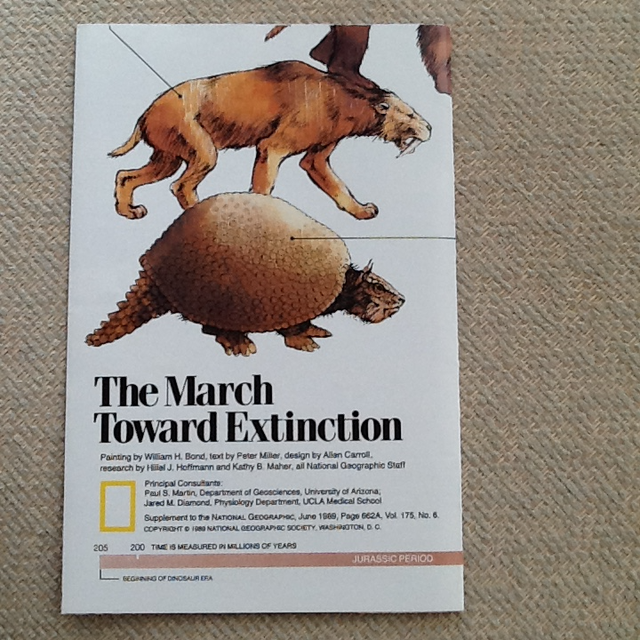
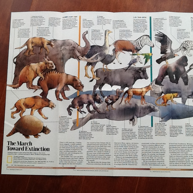
1..Dinosaurs Fold Out - The March Toward Extinction .
2- sided presentation - measures 15" x 20"
• 1st side has all the old animals marching toward extinction
(Depiction of the Jurassic Period, the Cretaceous Period, the Tertiary Period, and the Quaternary Period)
• 2nd side is a beautiful painted picture of A New View of Dinosaurs.
----------------------------------
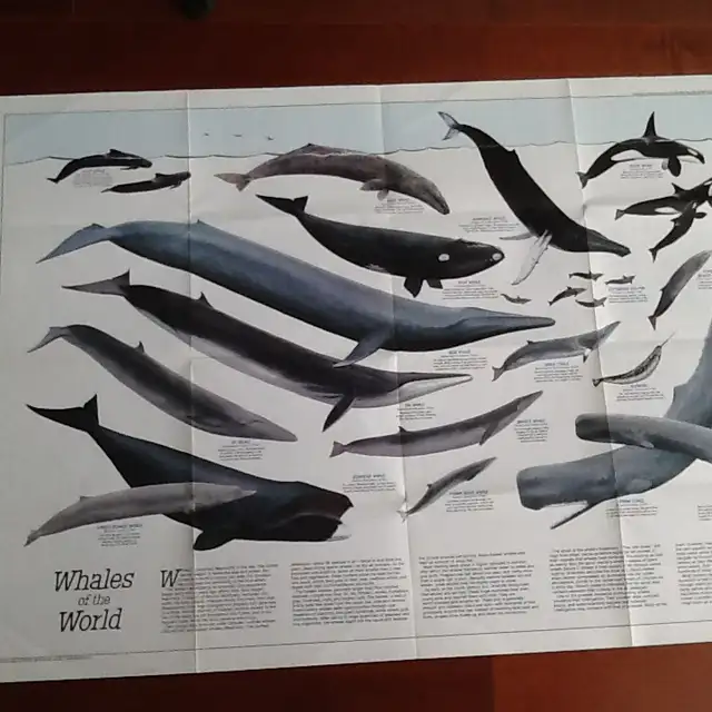
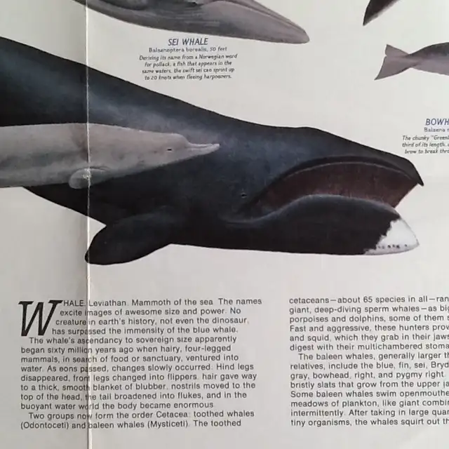
2.. Whales of the World & their Migration & Range
2-sided presentation
Learn about these giant creatures of the sea with a map that introduces 17 different whale species. Each whale is drawn to scale and includes scientific names and information about their size, feeding patterns, and history.
• 1st side has pictures and descriptions of all whales,
• 2nd side has their migrations and ranges NOMADS OF THE SEA-
---------------------------------------------
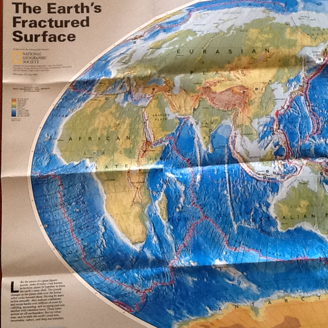
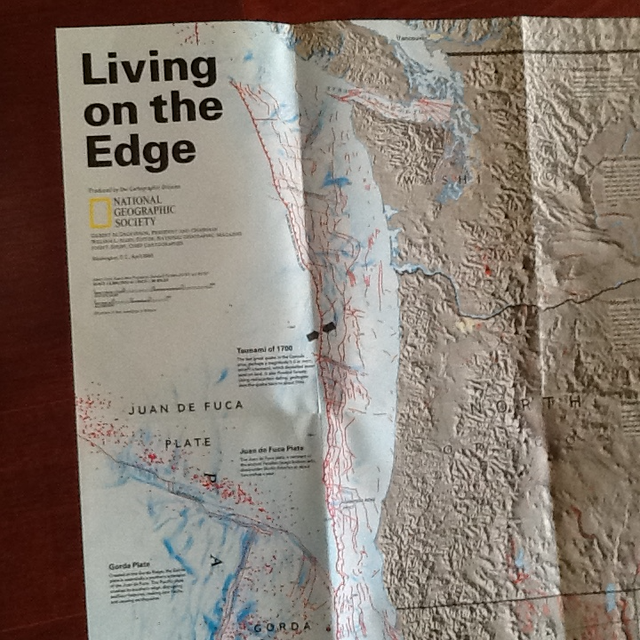
3 ..THE EARTH'S FRACTURED SURFACE EARTHQUAKE FAULTS MAP
and Living on the Edge - California Fault Lines Map
Where Tectonic Plates Meet
Seismology - Two-sided poster is in EXCELLENT - MINT condition.
This world map shows the continents, along with the lines of each tectonic plate, demonstrating the reaction between continental drift, earthquakes and volcanoes. It is 22" x 36".
------------------------------------
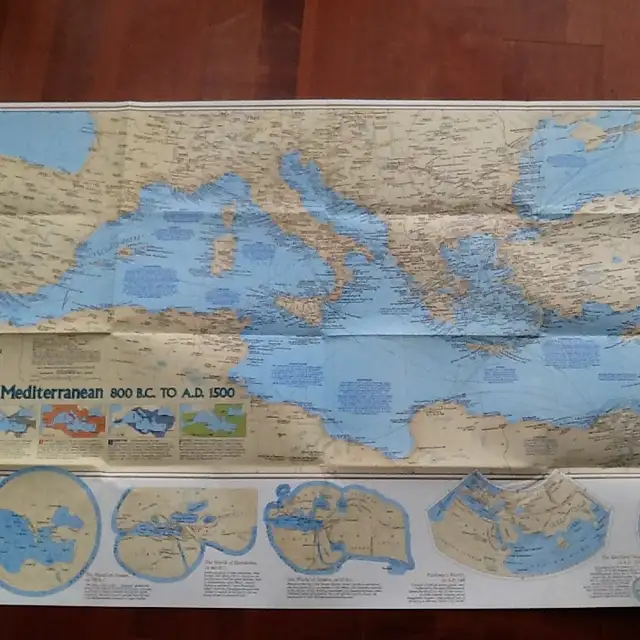
4.. Historic Mediterranean and the Seafloor Map
“..the Mediterranean has been moulded in a vice of colliding continents
This map is based off of bathymetric surveys - studies that allow us to measure the depths and characteristics of the ocean ..
Double-sided –Dimensions: 37” x 22”
One side reflects the Mediterranean Sea: As the Latin aptly translates, the Mediterranean Sea is a "sea in the middle of the land." And beneath its waters lies a chain of basins and striking features that reveal the forces of plate tectonics.
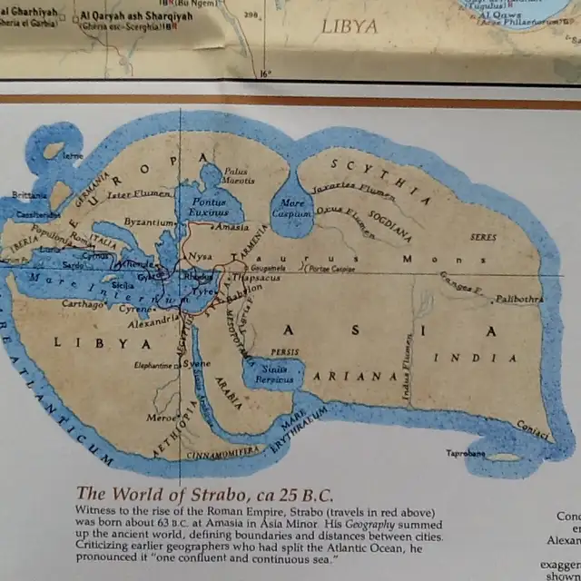
The reverse side features the Historic Mediterranean, 800BC to AD 1500 map, and provides stunning detail into these features.
-------------------------------------------------------
5...Deep - Sea Vents: Worlds Without Sun, Pacific Ocean Map
.. these self-sufficient communities of marine animals survive on energy derived not from the sun but from earth's interior….”
Dimensions: 31” x 20”
One side reflects the physical map of the Pacific Ocean floor and contains an article entitled "Deep-Sea Vents: Worlds Without Sun" and additional information on the life forms that thrive in the deepest waters of the Pacific.
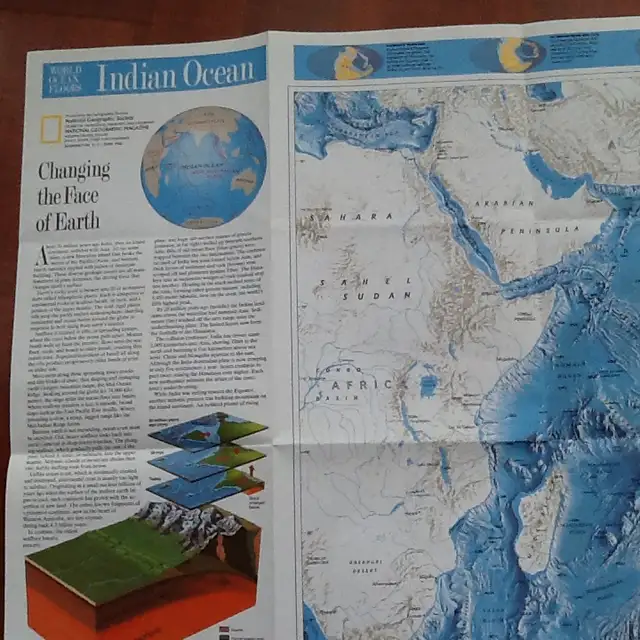
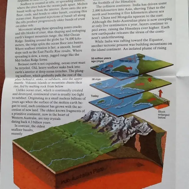
The reverse side contains an article entitled “Changing the Face of Earth”
Ocean floor illustrated in stunning relief
Illustrations and information about the creatures who live in the deepest parts of the ocean
An inset map showing the Pacific Ocean plates
An inset map showing the active spreading areas in the ocean and selected vent sites
Coverage Area: Pacific Ocean, Bering Sea, Gulf of Mexico, Philippine Sea, South China Sea, Sea of Okhotsk, Coral Sea, Tasman
For more info call or text 416-402-6008…
Pick up location very close to the Wynford exit off the DVP. (Intersections Eglinton, Don Mills, Wynford)
When you call please mention you found this ad listing on OKz.ca
Contact Information
| Contact Person | : | Sandy |
| Address | : | North York, ON M3C 3M8 |
| City | : | City of Toronto |
| Phone | : | 416-402-XXXX (Show) |
| Asking Price | : | $1 |
Other Information
| For Sale By | : | Owner |
| Fulfillment | : | Curbside Pick Up |
| Condition | : | Used - Good |
| Payment | : | Cash Accepted |